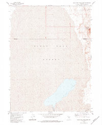
1980 Map of Black Rock Point West
USGS Topo · Published 1984About this map
The Black Rock Desert dominates this western Nevada landscape, appearing as a massive, featureless expanse that highlights the arid isolation of the Great Basin. This 1980 edition, based on earlier field checks and aerial photography, reveals a stark geography where water sources are critical but sparse. To the east, the shoreline of the playa is punctuated by thermal features like Black Rock Springs (Hot) and other unnamed Springs (Hot). These natural outlets, along with a solitary Well, represent the lifeblood of this desert environment. The Quinn River flows toward the southern portion of the sheet, while the prominent landmark of Black Rock Point rises above the basin floor. Human presence is minimal, marked only by a rudimentary Jeep Trail and the administrative boundary between Humboldt and Pershing counties.
Find a feature on this map
8 named features on this map. Tap any name to fly to it.
Don’t see what you’re looking for? This feature index may not catch every label — zoom into the map to look around manually.
Map Details
Editions of this 1980 Black Rock Point West Map
2 editions found
Other maps of this area

1886 · Disaster
USGS Topo · 1:250,000

1886 · Granite Range
USGS Topo · 1:250,000

1889 · Long Valley
USGS Topo · 1:250,000

1893 · Disaster
USGS Topo · 1:250,000

1894 · Granite Range
USGS Topo · 1:250,000

1931 · Lovelock
USGS Topo · 1:250,000

1935 · Lovelock
USGS Topo · 1:250,000

1954 · Vya
USGS Topo · 1:250,000

1955 · Lovelock
USGS Topo · 1:250,000

1958 · Vya
USGS Topo · 1:250,000