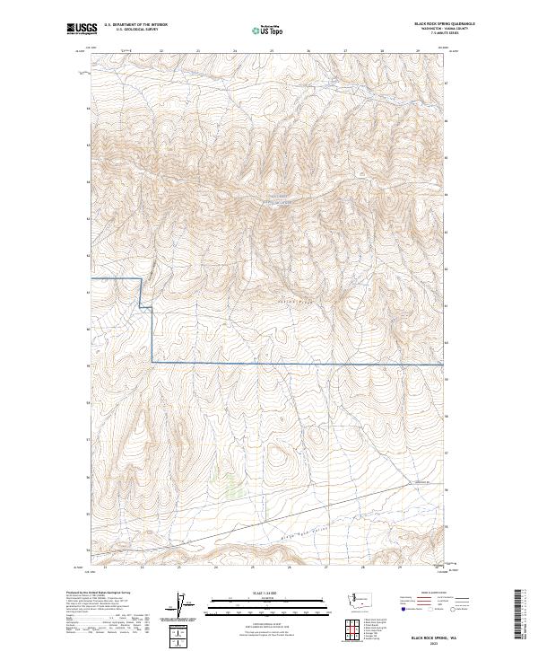
2023 Map of Black Rock Spring
USGS Topo · Published 2023About this map
Joint Base Lewis-Mcchord encompasses a significant portion of this high-desert landscape in central Washington, north of the sprawling Yakima Ridge. The terrain is defined by dry canyons and seasonal water sources, most notably the namesake Black Rock Spring and Nelson Spring, which have historically served as critical landmarks in this arid environment. The map captures the meeting point of high ridges and the wide Black Rock Valley to the south.
Find a feature on this map
11 named features on this map. Tap any name to fly to it.
Don’t see what you’re looking for? This feature index may not catch every label — zoom into the map to look around manually.
Map Details
Editions of this 2023 Black Rock Spring Map
This is the sole edition of this map. No revisions or reprints were ever made.
Other maps of this area

1910 · Zillah
USGS Topo · 1:125,000

1915 · Prosser
USGS Topo · 1:125,000

1917 · Priest Rapids
USGS Topo · 1:62,500

1917 · Prosser
USGS Topo · 1:125,000

1936 · Hog Ranch Buttes
USGS Topo · 1:48,000

1941 · Black Rock Spring
USGS Topo · 1:62,500

1948 · Cairn Hope Peak
USGS Topo · 1:24,000

1948 · Priest Rapids
USGS Topo · 1:24,000

1950 · Yakima
USGS Topo · 1:250,000

1950 · Grandview
USGS Topo · 1:62,500