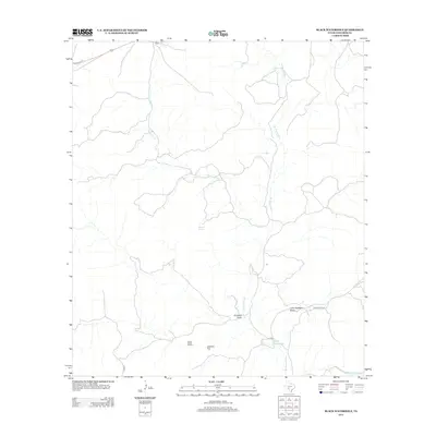
2013 Map of Black Waterhole
USGS Topo · Published 2013About this map
W Nueces River carves a winding path through this portion of Edwards County, defining a landscape shaped by intermittent water and sparse desert drainages. In a region where reliable water is the primary driver of human activity, the namesake Black Waterhole stands out as a critical landmark near Co RD 14. The map reveals a network of dry washes and canyons, including Crooked Draw and Little Hackberry Draw, which channel runoff into the main river valley. These natural features, alongside Silman Spring, represent the essential geography that dictated ranching and early travel routes in West Texas. Historical transit paths are visible in the layout of Old US Hwy 377 in the northwest, while the vast southern terrain is marked by Jackson Flat and Cedar Draw, showing how land use centers around the few level areas between the river's rugged breaks.
Find a feature on this map
13 named features on this map. Tap any name to fly to it.
Don’t see what you’re looking for? This feature index may not catch every label — zoom into the map to look around manually.
Map Details
Editions of this 2013 Black Waterhole Map
This is the sole edition of this map. No revisions or reprints were ever made.
Other maps of this area

1893 · Rock Springs
USGS Topo · 1:125,000

1893 · Nueces
USGS Topo · 1:125,000

1896 · Nueces
USGS Topo · 1:125,000

1943 · Carta Valley
USGS Topo · 1:62,500

1944 · Indian Creek
USGS Topo · 1:62,500

1954 · Sonora
USGS Topo · 1:250,000

1958 · Sonora
USGS Topo · 1:250,000

1958 · Del Rio
USGS Topo · 1:250,000

1964 · Del Rio
USGS Topo · 1:250,000
1971 · Ray Lake SE
USGS Topo · 1:24,000