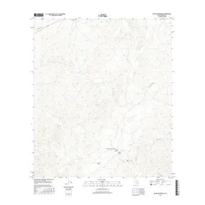
2016 Map of Black Waterhole
USGS Topo · Published 2016About this map
The W Nueces River carves a complex drainage network through this portion of Edwards County, where the dry-wash topography is defined by seasonal draws and isolated water sources. The namesake Black Waterhole and Silman Spring serve as critical hydrological markers in an arid landscape dominated by the winding course of Geronimo Cr and Possum Cr. This 2016 survey captures the intersection of modern transit and older routes, showing where Ranch Rd 674 and Old US Hwy 377 navigate the terrain.
Find a feature on this map
16 named features on this map. Tap any name to fly to it.
Don’t see what you’re looking for? This feature index may not catch every label — zoom into the map to look around manually.
Map Details
Editions of this 2016 Black Waterhole Map
This is the sole edition of this map. No revisions or reprints were ever made.
Other maps of this area

1893 · Rock Springs
USGS Topo · 1:125,000

1893 · Nueces
USGS Topo · 1:125,000

1896 · Nueces
USGS Topo · 1:125,000

1943 · Carta Valley
USGS Topo · 1:62,500

1944 · Indian Creek
USGS Topo · 1:62,500

1954 · Sonora
USGS Topo · 1:250,000

1958 · Sonora
USGS Topo · 1:250,000

1958 · Del Rio
USGS Topo · 1:250,000

1964 · Del Rio
USGS Topo · 1:250,000
1971 · Ray Lake SE
USGS Topo · 1:24,000