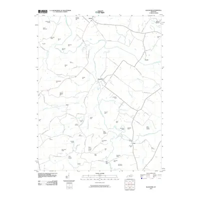
2010 Map of Blackford
USGS Topo · Published 2010About this map
The Tradewater River winds through this section of Western Kentucky, defining the landscape between the settlements of Sullivan and Blackford. This survey captures a rural environment characterized by a high density of family-named landmarks and upland terrain features. Genealogists will find a wealth of specific local history preserved here, from the numerous burial grounds like Nunn Cemetery and Kilpatrick Cemetery to uniquely named peaks such as Carding Machine Hill and Kelly Orr Hill Middle Knob.
Find a feature on this map
86 named features on this map. Tap any name to fly to it.
Don’t see what you’re looking for? This feature index may not catch every label — zoom into the map to look around manually.
Map Details
Editions of this 2010 Blackford Map
This is the sole edition of this map. No revisions or reprints were ever made.
Other maps of this area

1907 · Morganfield
USGS Topo · 1:62,500

1909 · Providence
USGS Topo · 1:62,500

1916 · Shawneetown
USGS Topo · 1:62,500

1916 · Fords Ferry
USGS Topo · 1:62,500

1921 · Fords Ferry
USGS Topo · 1:48,000

1925 · Cave In Rock
USGS Topo · 1:62,500

1949 · Paducah
USGS Topo · 1:250,000

1950 · Paducah
USGS Topo · 1:250,000
1951 · Bordley
USGS Topo · 1:24,000

1951 · Sturgis
USGS Topo · 1:24,000