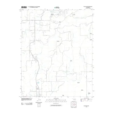
2010 Map of Blackgum
USGS Topo · Published 2010About this map
Blackgum Mountain and Chuculate Mountain anchor this portion of the Oklahoma landscape, where the terrain is defined by a series of prominent peaks and deep hollows. This 2010 survey details a rural network of roads like Evening Shade Rd and Vian Creek Rd that wind through the upland topography of Anderson Mountain and Lizzard Mountain. For those researching local heritage, the map identifies significant sites such as the Cherokee-McCoy Cemetery and Barnisky Cemetery, alongside the Vian Garden of Memories near the shores of Vian Lake. The drainage system is clearly visible, with Vian Creek, Pinhook Creek, and Little Vian Creek carving through the valleys, while the Sallisaw Creek Site 3 Dam marks a point of modern water management in the southeastern corner.
Find a feature on this map
52 named features on this map. Tap any name to fly to it.
Don’t see what you’re looking for? This feature index may not catch every label — zoom into the map to look around manually.
Map Details
Editions of this 2010 Blackgum Map
This is the sole edition of this map. No revisions or reprints were ever made.
Other maps of this area

1898 · Tahlequah
USGS Topo · 1:125,000

1900 · Sansbois
USGS Topo · 1:125,000

1900 · Sallisaw
USGS Topo · 1:125,000

1901 · Muscogee
USGS Topo · 1:125,000

1901 · Tahlequah
USGS Topo · 1:125,000

1905 · Muscogee
USGS Topo · 1:125,000

1905 · Tahlequah
USGS Topo · 1:125,000

1909 · Sans Bois
USGS Topo · 1:125,000

1911 · Sallisaw
USGS Topo · 1:125,000

1911 · Sansbois
USGS Topo · 1:125,000