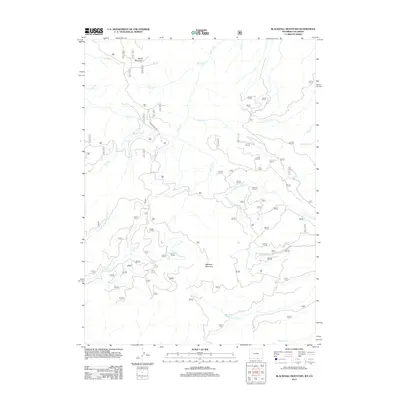
2012 Map of Blackhall Mountain
USGS Topo · Published 2012About this map
Blackhall Mountain and Wood Mountain dominate this high-altitude landscape in the Sierra Madre Range along the Wyoming-Colorado border. This 2012 survey captures a wilderness defined by a complex drainage network, where the E Fork Encampment River and Coon Cr carve through the western slopes. The map reveals a high-country environment accessible primarily via Black Hall Rd, which winds through the central terrain between Billie Cr and Etna Cr. To the east, the headwaters of the Big Creek system emerge, including the N Fork Big Cr and Middle Fork Big Cr, alongside smaller tributaries like McAnulty Creek. This data is essential for understanding the modern hydrological and topographical state of this remote Carbon County region, serving as a precise guide for those studying the peaks and creeks of the Continental Divide area.
Find a feature on this map
19 named features on this map. Tap any name to fly to it.
Don’t see what you’re looking for? This feature index may not catch every label — zoom into the map to look around manually.
Map Details
Editions of this 2012 Blackhall Mountain Map
This is the sole edition of this map. No revisions or reprints were ever made.
Other maps of this area

1911 · Hahns Peak
USGS Topo · 1:125,000

1913 · Hahns Peak
USGS Topo · 1:125,000

1939 · Saratoga
USGS Topo · 1:125,000

1954 · Rawlins
USGS Topo · 1:250,000

1954 · Craig
USGS Topo · 1:250,000

1955 · Davis Peak
USGS Topo · 1:24,000

1955 · Pearl
USGS Topo · 1:24,000

1956 · Pearl
USGS Topo · 1:62,500

1957 · Craig
USGS Topo · 1:250,000

1958 · Rawlins
USGS Topo · 1:250,000