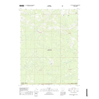
2017 Map of Blackhall Mountain
USGS Topo · Published 2017About this map
Blackhall Mtn stands as a prominent topographical anchor near the state line in this 2017 study of the high-elevation wilderness where Wyoming meets Colorado. The landscape is defined by the protected lands of Medicine Bow National Forest and Routt National Forest, creating a continuous corridor of forested terrain. A complex network of drainage systems radiates from the central peaks, including the headwaters of the E Fork Encampment River and the various branches of the Big Creek system, such as Middle Fork Big Cr and N Fork Big Cr. Human impact is minimal and concentrated on seasonal access, primarily via Black Hall Rd, which winds through the northwestern section. The map documents the intricate hydrography of the region, from the narrow passages of Addison Gulch and Turnbull Gulch to the steady flow of Little Beaver Cr.
Find a feature on this map
30 named features on this map. Tap any name to fly to it.
Don’t see what you’re looking for? This feature index may not catch every label — zoom into the map to look around manually.
Map Details
Editions of this 2017 Blackhall Mountain Map
This is the sole edition of this map. No revisions or reprints were ever made.
Other maps of this area

1911 · Hahns Peak
USGS Topo · 1:125,000

1913 · Hahns Peak
USGS Topo · 1:125,000

1939 · Saratoga
USGS Topo · 1:125,000

1954 · Rawlins
USGS Topo · 1:250,000

1954 · Craig
USGS Topo · 1:250,000

1955 · Davis Peak
USGS Topo · 1:24,000

1955 · Pearl
USGS Topo · 1:24,000

1956 · Pearl
USGS Topo · 1:62,500

1957 · Craig
USGS Topo · 1:250,000

1958 · Rawlins
USGS Topo · 1:250,000