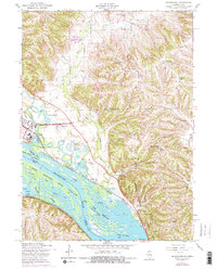
1953 Map of Blackhawk
USGS Topo · Published 1977About this map
Mississippi River backwaters and the high bluffs of Mississippi Palisades State Park define this stretch of the Illinois and Iowa border. The landscape is a study in contrasting elevations, from the low-lying Upper Mississippi River Wild Life and Fish Refuge with its complex network of sloughs like Pinoak Slough and Hickory Slough, to the steep ridges of Mosquito Hill and Heer Hill. The 1950s infrastructure shows the heavy footprint of the Savanna Army Depot and the convergence of major rail lines, including the Chicago Burlington and Quincy and the Chicago Milwaukee St Paul and Pacific. Rural life is meticulously documented through family-named schools and churches, such as Knapp Sch and Holy Trinity Ch, serving the agricultural uplands of Hanover and Derinda townships. Early recreational developments appear at Santa Fe Beach and the Palisades Country Club, while the small settlement of Blackhawk sits nestled between the bluffs and the river.
Find a feature on this map
45 named features on this map. Tap any name to fly to it.
Don’t see what you’re looking for? This feature index may not catch every label — zoom into the map to look around manually.
Map Details
Editions of this 1953 Blackhawk Map
3 editions found
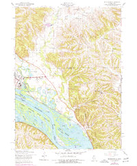
Other maps of this area

1892 · Savanna
USGS Topo · 1:62,500

1911 · Elizabeth
USGS Topo · 1:62,500

1911 · Galena
USGS Topo · 1:62,500

1913 · Galena
USGS Topo · 1:62,500

1935 · Miles
USGS Topo · 1:62,500

1936 · Elizabeth
USGS Topo · 1:62,500

1941 · Miles
USGS Topo · 1:62,500

1952 · Savanna
USGS Topo · 1:62,500

1953 · Blackhawk
USGS Topo · 1:24,000

1953 · Green Island
USGS Topo · 1:24,000