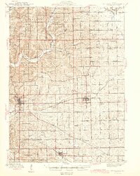
1944 Map of Mt. Carroll
USGS Topo · Published 1944About this map
A dense network of one-room schoolhouses and rural churches defines this section of northern Illinois during the early 1940s. The landscape is bisected by three major railroads, including the Chicago Milwaukee St Paul and Pacific which serves the community of Lanark, and the Chicago Great Western passing through the northern hills near Loran. The county seat of Mt Carroll sits as a primary hub, while smaller rail-related stops like Ashdale Junc and Chadwick show the era's reliance on steel rails for local commerce.
Find a feature on this map
76 named features on this map. Tap any name to fly to it.
Don’t see what you’re looking for? This feature index may not catch every label — zoom into the map to look around manually.
Map Details
Editions of this 1944 Mt. Carroll Map
2 editions found

Other maps of this area

1891 · Clinton
USGS Topo · 1:62,500

1892 · Savanna
USGS Topo · 1:62,500

1894 · Clinton
USGS Topo · 1:62,500

1899 · Clinton
USGS Topo · 1:125,000

1911 · Elizabeth
USGS Topo · 1:62,500

1930 · Woodsung
USGS Topo · 1:48,000

1934 · Morrison
USGS Topo · 1:48,000

1936 · Elizabeth
USGS Topo · 1:62,500

1937 · Lena
USGS Topo · 1:48,000

1939 · Freeport
USGS Topo · 1:48,000