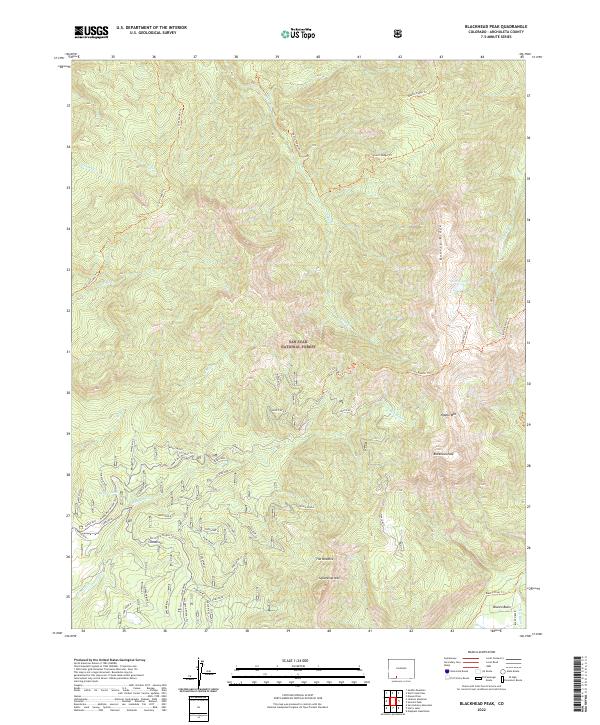
2022 Map of Blackhead Peak
USGS Topo · Published 2022About this map
San Juan National Forest covers the high alpine reaches of the Southern Rockies in this 2022 survey, defined by the towering summits of Blackhead Peak and Squaretop Mtn. The landscape is a complex network of glacial-carved ridges and river basins, where the headwaters of the Rio Blanco and Rito Blanco begin their descent. While much of the terrain is wild and dominated by landmarks like The Needles and Quartz Ridge, evidence of human activity is found in the scattered structures at Oppenheimer and the established routes into the Blanco Basin.
Find a feature on this map
29 named features on this map. Tap any name to fly to it.
Don’t see what you’re looking for? This feature index may not catch every label — zoom into the map to look around manually.
Map Details
Editions of this 2022 Blackhead Peak Map
This is the sole edition of this map. No revisions or reprints were ever made.
Other maps of this area

1913 · Summitville
USGS Topo · 1:125,000

1915 · Summitville
USGS Topo · 1:125,000

1945 · Durango
USGS Topo · 1:250,000

1953 · Durango
USGS Topo · 1:250,000

1954 · Durango
USGS Topo · 1:250,000

1957 · Chromo
USGS Topo · 1:62,500

1957 · Wolf Creek Pass
USGS Topo · 1:62,500

1957 · Chama Peak
USGS Topo · 1:62,500

1961 · Durango
USGS Topo · 1:250,000

1963 · Durango
USGS Topo · 1:250,000