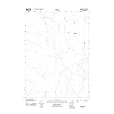
2012 Map of Blackpipe
USGS Topo · Published 2012About this map
Blackpipe sits within the high plains of Bennett County, a landscape defined by the drainage networks of several seasonal and perennial waterways. The hydrology is dominated by the meandering course of Black Pipe Cr in the east and the branching tributaries of Cottonwood Cr, which carve through the prairie terrain. Significant water features like Bull Cr and Lost Turkey Cr further illustrate the importance of these natural channels in an area where the grid of county roads, such as Moose Rd and Bobcat Rd, provides the primary structure for movement across the open country. This 2012 survey illustrates the sparse settlement pattern and the vast agricultural or ranching sections that characterize this portion of South Dakota, showing how local transit relies on a network of routes like Antelope Rd and Pioneer Ln to connect isolated homesteads.
Find a feature on this map
13 named features on this map. Tap any name to fly to it.
Don’t see what you’re looking for? This feature index may not catch every label — zoom into the map to look around manually.
Map Details
Editions of this 2012 Blackpipe Map
This is the sole edition of this map. No revisions or reprints were ever made.
Other maps of this area

1955 · Martin
USGS Topo · 1:250,000

1958 · Martin
USGS Topo · 1:250,000

1969 · Norris
USGS Topo · 1:24,000

1969 · Eagle Mans Butte
USGS Topo · 1:24,000

1969 · Iron Shell Flat West
USGS Topo · 1:24,000

1981 · Long Valley
USGS Topo · 1:25,000

1981 · Blackpipe
USGS Topo · 1:25,000

1981 · Tuthill
USGS Topo · 1:25,000

1983 · Martin
USGS Topo · 1:100,000
2012 · Tuthill
USGS Topo · 1:24,000