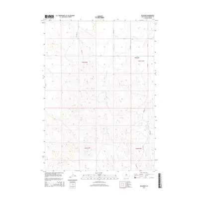
2015 Map of Blackpipe
USGS Topo · Published 2015About this map
The high plains of Bennett County come into focus through the drainage systems of Black Pipe Cr and Cottonwood Cr, which carve through the terrain south of the Blackpipe settlement. This 2015 survey illustrates a rural landscape defined by section lines and an sparse network of named roads including Moose Rd, Bobcat Rd, and Antelope Rd. The topography is marked by significant elevation changes between the creek beds and the surrounding ridges, particularly where Bull Cr and Lost Turkey Cr converge in the northern sections. While Blackpipe serves as the primary named community center, the map primarily documents the enduring Public Land Survey System grid, showing the township and range divisions of T39N and T38N that have shaped South Dakota land ownership for generations.
Find a feature on this map
17 named features on this map. Tap any name to fly to it.
Don’t see what you’re looking for? This feature index may not catch every label — zoom into the map to look around manually.
Map Details
Editions of this 2015 Blackpipe Map
This is the sole edition of this map. No revisions or reprints were ever made.
Other maps of this area

1955 · Martin
USGS Topo · 1:250,000

1958 · Martin
USGS Topo · 1:250,000

1969 · Norris
USGS Topo · 1:24,000

1969 · Eagle Mans Butte
USGS Topo · 1:24,000

1969 · Iron Shell Flat West
USGS Topo · 1:24,000

1981 · Long Valley
USGS Topo · 1:25,000

1981 · Blackpipe
USGS Topo · 1:25,000

1981 · Tuthill
USGS Topo · 1:25,000

1983 · Martin
USGS Topo · 1:100,000
2012 · Tuthill
USGS Topo · 1:24,000