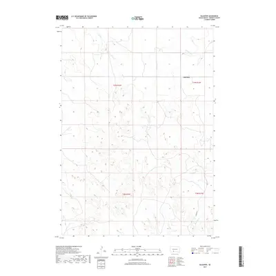
2017 Map of Blackpipe
USGS Topo · Published 2017About this map
Blackpipe sits at a crossroads in the northern plains of Bennett County, where the topography is defined by the drainage basins of the Missouri River watershed. The landscape is carved by several distinct waterways, including Bull Cr and Cottonwood Cr in the north, while Black Pipe Cr cuts through the southeastern corner. This 2017 survey details a region organized by the Public Land Survey System, showing the transition between T39N and T38N across ranges R34W and R33W. The map reflects a predominantly rural and agricultural layout, with Putnam Rd providing one of the primary transit corridors through the rolling terrain. The intricate contour lines illustrate the complex draws and ridges characteristic of this section of South Dakota, offering a precise view of the local drainage patterns and land elevation.
Find a feature on this map
9 named features on this map. Tap any name to fly to it.
Don’t see what you’re looking for? This feature index may not catch every label — zoom into the map to look around manually.
Map Details
Editions of this 2017 Blackpipe Map
This is the sole edition of this map. No revisions or reprints were ever made.
Other maps of this area

1955 · Martin
USGS Topo · 1:250,000

1958 · Martin
USGS Topo · 1:250,000

1969 · Norris
USGS Topo · 1:24,000

1969 · Eagle Mans Butte
USGS Topo · 1:24,000

1969 · Iron Shell Flat West
USGS Topo · 1:24,000

1981 · Long Valley
USGS Topo · 1:25,000

1981 · Blackpipe
USGS Topo · 1:25,000

1981 · Tuthill
USGS Topo · 1:25,000

1983 · Martin
USGS Topo · 1:100,000
2012 · Tuthill
USGS Topo · 1:24,000