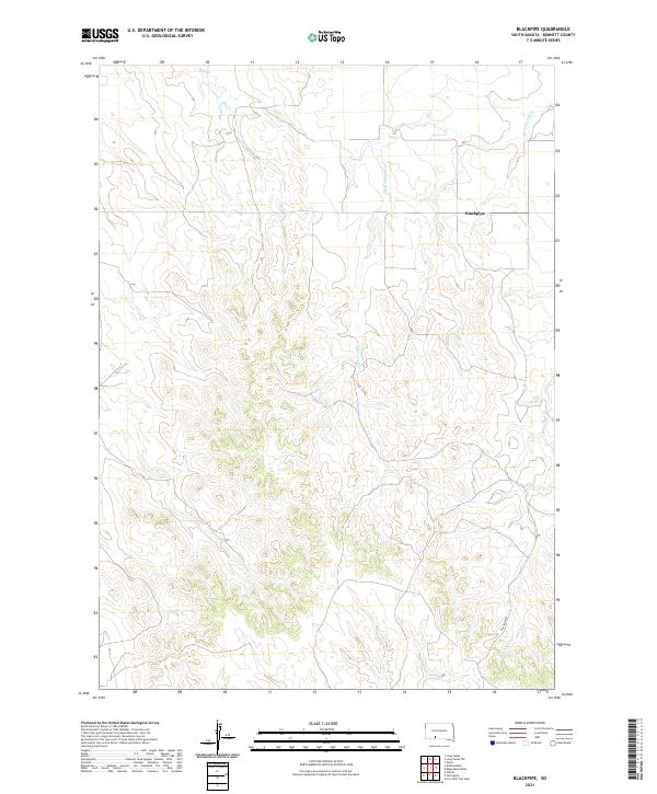
2021 Map of Blackpipe
USGS Topo · Published 2021About this map
Blackpipe sits within the high plains landscape of Bennett County, a region defined by its seasonal drainages and expansive ranching tracts. This 2021 survey illustrates how the local hydrography, including the winding paths of Cottonwood Cr and Bull Cr, continues to dictate the layout of the land across the various townships and ranges. The settlement pattern here is sparse, characteristic of the modern western South Dakota frontier where vast distances separate small communities. Black Pipe Cr cuts through the southern reaches of the quadrangle, serving as a primary geographical marker in an area where developed roads like Putnam Rd are the few man-made landmarks. The map effectively documents the intersection of public land survey systems and natural watercourses that have remained the foundation of local property and navigation for generations.
Find a feature on this map
9 named features on this map. Tap any name to fly to it.
Don’t see what you’re looking for? This feature index may not catch every label — zoom into the map to look around manually.
Map Details
Editions of this 2021 Blackpipe Map
This is the sole edition of this map. No revisions or reprints were ever made.
Other maps of this area

1955 · Martin
USGS Topo · 1:250,000

1958 · Martin
USGS Topo · 1:250,000

1969 · Norris
USGS Topo · 1:24,000

1969 · Eagle Mans Butte
USGS Topo · 1:24,000

1969 · Iron Shell Flat West
USGS Topo · 1:24,000

1981 · Long Valley
USGS Topo · 1:25,000

1981 · Blackpipe
USGS Topo · 1:25,000

1981 · Tuthill
USGS Topo · 1:25,000

1983 · Martin
USGS Topo · 1:100,000
2012 · Tuthill
USGS Topo · 1:24,000