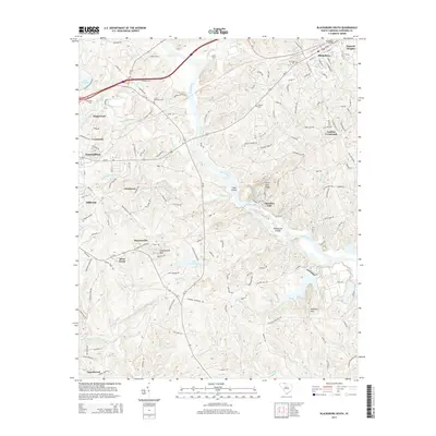
2014 Map of Blacksburg South
USGS Topo · Published 2014About this map
The Broad River defines the central topography of this Cherokee County region, winding past Goat Island and through the complex of Ninetynine Islands before reaching Cherokee Falls. The landscape is a mix of small settlements and named ridges, with Blacksburg situated in the northeast and neighborhoods like Maplewood, Crestmont, and East Gaffney clustered along the western edge. This 2014 survey documents a territory where modern infrastructure, such as the Speedway Rd and Frontage Rd, intersects with older local landmarks. Genealogists will find a high density of rural burial sites, including Ross Cem, Lipscomb Cem, and Mtn View Cem. The terrain rises significantly at Draytonville Mtn and Mckowns Mtn, overlooking a network of creeks like Buffalo Creek and Canoe Cr that feed into the river system.
Find a feature on this map
135 named features on this map. Tap any name to fly to it.
Don’t see what you’re looking for? This feature index may not catch every label — zoom into the map to look around manually.
Map Details
Editions of this 2014 Blacksburg South Map
This is the sole edition of this map. No revisions or reprints were ever made.
Other maps of this area

1906 · Kings Mountain
USGS Topo · 1:62,500

1907 · Sharon
USGS Topo · 1:62,500

1908 · Kings Mountain
USGS Topo · 1:62,500

1909 · Gaffney
USGS Topo · 1:62,500

1941 · Spartanburg
USGS Topo · 1:250,000

1953 · Spartanburg
USGS Topo · 1:250,000

1953 · Charlotte
USGS Topo · 1:250,000

1954 · Charlotte
USGS Topo · 1:250,000

1960 · Charlotte
USGS Topo · 1:250,000

1960 · Spartanburg
USGS Topo · 1:250,000