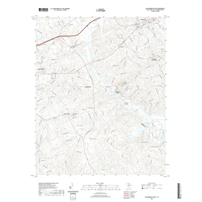
2020 Map of Blacksburg South
USGS Topo · Published 2020About this map
The Broad River carves a deep path through Cherokee County, separating the industrial and residential centers of Blacksburg and Gaffney. This river corridor is defined by complex hydrology, featuring The Rapids and the distinctive Ninetynine Islands downstream from Goat Island. Near the settlement of Cherokee Falls, the terrain rises toward Silver Mine Ridge, hinting at the mineral history of the region. The map captures a landscape where industry and heritage meet, shown by the Southern railroad lines and several long-standing community centers. Local history is anchored by several sites of worship and rest, including the Little Memorial Baptist Church and Galilee Baptist Church, alongside numerous family and community burial grounds such as Mountain View Cem and Lipscomb Cem. From the heights of Draytonville Mtn to the quiet stretches of Canoe Cr, the area's geography reflects a deeply rooted South Carolina Piedmont community.
Find a feature on this map
177 named features on this map. Tap any name to fly to it.
Don’t see what you’re looking for? This feature index may not catch every label — zoom into the map to look around manually.
Map Details
Editions of this 2020 Blacksburg South Map
This is the sole edition of this map. No revisions or reprints were ever made.
Other maps of this area

1906 · Kings Mountain
USGS Topo · 1:62,500

1907 · Sharon
USGS Topo · 1:62,500

1908 · Kings Mountain
USGS Topo · 1:62,500

1909 · Gaffney
USGS Topo · 1:62,500

1941 · Spartanburg
USGS Topo · 1:250,000

1953 · Spartanburg
USGS Topo · 1:250,000

1953 · Charlotte
USGS Topo · 1:250,000

1954 · Charlotte
USGS Topo · 1:250,000

1960 · Charlotte
USGS Topo · 1:250,000

1960 · Spartanburg
USGS Topo · 1:250,000