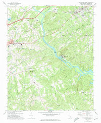
1971 Map of Blacksburg South
USGS Topo · Published 1974About this map
The Broad River serves as the central artery for this South Carolina landscape, carving a path through the rolling terrain between the industrial edges of Gaffney and the town of Blacksburg. In the early 1970s, the river environment is marked by significant features like Goat Island and the complex waters of Ninety-nine Islands. To the east, the village of Cherokee Falls sits near the riverbank, while the upland areas are defined by local landmarks such as Silver Mine Ridge and Draytonville Mtn, the latter topped with a lookout tower.
Find a feature on this map
58 named features on this map. Tap any name to fly to it.
Don’t see what you’re looking for? This feature index may not catch every label — zoom into the map to look around manually.
Map Details
Editions of this 1971 Blacksburg South Map
This is the sole edition of this map. No revisions or reprints were ever made.
Other maps of this area

1906 · Kings Mountain
USGS Topo · 1:62,500

1907 · Sharon
USGS Topo · 1:62,500

1908 · Kings Mountain
USGS Topo · 1:62,500

1909 · Gaffney
USGS Topo · 1:62,500

1941 · Spartanburg
USGS Topo · 1:250,000

1953 · Spartanburg
USGS Topo · 1:250,000

1953 · Charlotte
USGS Topo · 1:250,000

1954 · Charlotte
USGS Topo · 1:250,000

1960 · Charlotte
USGS Topo · 1:250,000

1960 · Spartanburg
USGS Topo · 1:250,000