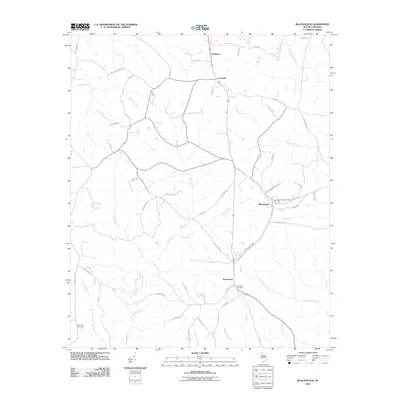
2011 Map of Blackstock
USGS Topo · Published 2011About this map
Blackstock and Woodward anchor this South Carolina landscape, reflecting a long history of rural settlement and agriculture in Fairfield and Chester Counties. The map reveals a network of country roads named for local families and landmarks, such as Hopewell Church RD and Douglas School RD, which point to the locations of former community centers. Waterways like Big Wateree Creek and the Little River wind through the terrain, historically influencing farm boundaries and travel routes. Genealogists will find significant value in the documentation of several burial sites, including the Blackstock Cemetery, Concord Cemetery, and New Hope Cemetery. The small settlements of McKeown and Cornwell further illustrate the distribution of small-scale hamlets across this piedmont region as it appeared in the early 21st century.
Find a feature on this map
58 named features on this map. Tap any name to fly to it.
Don’t see what you’re looking for? This feature index may not catch every label — zoom into the map to look around manually.
Map Details
Editions of this 2011 Blackstock Map
This is the sole edition of this map. No revisions or reprints were ever made.
Other maps of this area

1904 · Columbia
USGS Topo · 1:125,000

1941 · Spartanburg
USGS Topo · 1:250,000

1953 · Spartanburg
USGS Topo · 1:250,000

1960 · Spartanburg
USGS Topo · 1:250,000

1963 · Spartanburg
USGS Topo · 1:250,000

1964 · Spartanburg
USGS Topo · 1:250,000

1968 · Blackstock
USGS Topo · 1:24,000

1969 · Lebanon
USGS Topo · 1:24,000
1969 · Salem Crossroads
USGS Topo · 1:24,000
1969 · Winnsboro
USGS Topo · 1:24,000