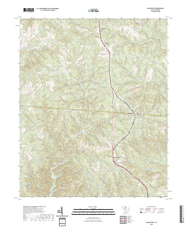
2024 Map of Blackstock
USGS Topo · Published 2024About this map
Blackstock sits along the border of Chester Co and Fairfield Co, anchoring a rural landscape defined by historic settlements and an intricate network of waterways. Following the path of Columbia Rd, the terrain transitions between the small communities of Cornwell and Woodward. Local history is preserved in sites like the Concord Church Graveyard and New Hope Church Graveyard, which offer touchpoints for genealogical research in this portion of the South Carolina Piedmont.
Find a feature on this map
48 named features on this map. Tap any name to fly to it.
Don’t see what you’re looking for? This feature index may not catch every label — zoom into the map to look around manually.
Map Details
Editions of this 2024 Blackstock Map
This is the sole edition of this map. No revisions or reprints were ever made.
Other maps of this area

1904 · Columbia
USGS Topo · 1:125,000

1941 · Spartanburg
USGS Topo · 1:250,000

1953 · Spartanburg
USGS Topo · 1:250,000

1960 · Spartanburg
USGS Topo · 1:250,000

1963 · Spartanburg
USGS Topo · 1:250,000

1964 · Spartanburg
USGS Topo · 1:250,000

1968 · Blackstock
USGS Topo · 1:24,000

1969 · Lebanon
USGS Topo · 1:24,000
1969 · Salem Crossroads
USGS Topo · 1:24,000
1969 · Winnsboro
USGS Topo · 1:24,000