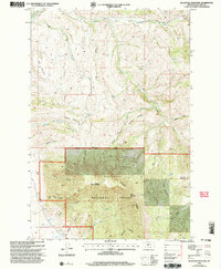
2000 Map of Blacktail Mountain
USGS Topo · Published 2005About this map
Gallatin National Forest dominates this landscape, where the high ridges of the Bridger Range meet the complex drainage systems of the Montana backcountry. The terrain is defined by a series of prominent peaks, including Blacktail Mountain, Zade Mountain, and Horsethief Mountain, which separate numerous canyons and gulches. The Bozeman Ranger District manages this area, where the headwaters of Sixteenmile Creek and its many forks carve through the mountain passes.
Find a feature on this map
30 named features on this map. Tap any name to fly to it.
Don’t see what you’re looking for? This feature index may not catch every label — zoom into the map to look around manually.
Map Details
Editions of this 2000 Blacktail Mountain Map
This is the sole edition of this map. No revisions or reprints were ever made.
Other maps of this area

1886 · Fort Logan
USGS Topo · 1:250,000

1886 · Little Belt Mts.
USGS Topo · 1:250,000

1888 · Three Forks
USGS Topo · 1:250,000

1891 · Livingston
USGS Topo · 1:250,000

1893 · Livingston
USGS Topo · 1:250,000

1894 · Three Forks
USGS Topo · 1:250,000

1894 · Little Belt Mts.
USGS Topo · 1:250,000

1895 · Three Forks
USGS Topo · 1:250,000

1897 · Little Belt Mts.
USGS Topo · 1:250,000

1898 · Little Belt Mts.
USGS Topo · 1:250,000