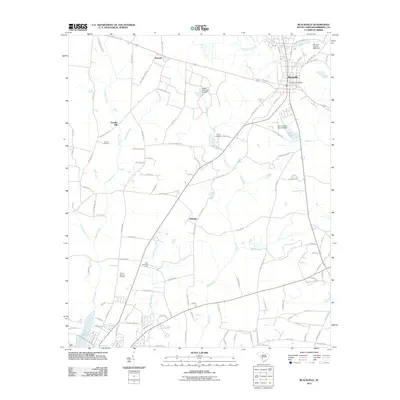
2011 Map of Blackville
USGS Topo · Published 2011About this map
The town of Blackville serves as the focal point of this South Carolina landscape, where the Blackville Post Office marks the center of local commerce and activity. The terrain is defined by a intricate network of waterways, including the upper reaches of the Salkehatchie River and numerous tributaries such as Toby Creek and Turkey Creek. Small rural settlements like Reynold, Ashleigh, and Farrells Mill are connected by a web of local roads, illustrating the area's historical settlement patterns and agrarian roots.
Find a feature on this map
111 named features on this map. Tap any name to fly to it.
Don’t see what you’re looking for? This feature index may not catch every label — zoom into the map to look around manually.
Map Details
Editions of this 2011 Blackville Map
This is the sole edition of this map. No revisions or reprints were ever made.
Other maps of this area

1919 · Olar
USGS Topo · 1:62,500

1919 · Bamberg
USGS Topo · 1:48,000

1919 · Allendale
USGS Topo · 1:62,500

1920 · Bamberg
USGS Topo · 1:62,500

1923 · Williston
USGS Topo · 1:48,000

1927 · Williston
USGS Topo · 1:62,500

1943 · Olar
USGS Topo · 1:62,500

1943 · Allendale
USGS Topo · 1:62,500

1943 · Bamberg
USGS Topo · 1:62,500

1943 · Williston
USGS Topo · 1:62,500