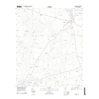
2014 Map of Blackville
USGS Topo · Published 2014About this map
Blackville serves as the central hub of this Barnwell County landscape, where the intersection of Us-78 and several state routes defines the local geography. The map reveals a transition from the structured street grid of the town to the dispersed rural settlements of Farrells Mill, Reynold, and Ashleigh. Water plays a significant role in the area's layout, with Toby Cr and its tributaries like Shrub Br and Windy Hill Cr carving through the terrain. To the south, the city of Barnwell borders Edgar A Brown Lake, a prominent feature near the Turkey Creek drainage. For those tracing local heritage, the map identifies key memorial sites such as Hope Memorial Park, County Memory Gardens, and the more secluded Jowers Cem. The presence of the Little Salkehatchie River and its associated wetlands like Sheepford Br further illustrates the low-lying, water-rich environment of this coastal plain region.
Find a feature on this map
116 named features on this map. Tap any name to fly to it.
Don’t see what you’re looking for? This feature index may not catch every label — zoom into the map to look around manually.
Map Details
Editions of this 2014 Blackville Map
This is the sole edition of this map. No revisions or reprints were ever made.
Other maps of this area

1919 · Olar
USGS Topo · 1:62,500

1919 · Bamberg
USGS Topo · 1:48,000

1919 · Allendale
USGS Topo · 1:62,500

1920 · Bamberg
USGS Topo · 1:62,500

1923 · Williston
USGS Topo · 1:48,000

1927 · Williston
USGS Topo · 1:62,500

1943 · Olar
USGS Topo · 1:62,500

1943 · Allendale
USGS Topo · 1:62,500

1943 · Bamberg
USGS Topo · 1:62,500

1943 · Williston
USGS Topo · 1:62,500