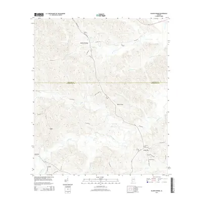
2014 Map of Bladon Springs
USGS Topo · Published 2014About this map
Bladon Springs and the surrounding piney woods of the Alabama Black Belt are detailed in this 2014 survey. The map centers on the border of Choctaw and Washington Counties, following the winding course of Santa-Bogue Cr and Sea Warrior Cr. Small, established settlements like Frankville and Silver Cross are documented alongside numerous family and community burial grounds, including the McDowell Cem and Friendship Cem. The road network, comprising routes like Frankville Rd and CR-31, connects these rural outposts through a landscape defined by creeks such as Caney Cr and Seyouyah Cr. Genealogists will find particular value in the high density of named cemeteries scattered across the terrain, from Pleasant Hill Cem in the southwest to Grenade Cem near the eastern margin.
Find a feature on this map
50 named features on this map. Tap any name to fly to it.
Don’t see what you’re looking for? This feature index may not catch every label — zoom into the map to look around manually.
Map Details
Editions of this 2014 Bladon Springs Map
This is the sole edition of this map. No revisions or reprints were ever made.
Other maps of this area

1953 · Hattiesburg
USGS Topo · 1:250,000

1958 · Hattiesburg
USGS Topo · 1:250,000

1971 · Bigbee
USGS Topo · 1:24,000

1971 · Coffeeville
USGS Topo · 1:24,000

1971 · Bladon Springs
USGS Topo · 1:24,000

1971 · Coffeeville Lock And Dam
USGS Topo · 1:24,000

1972 · Tattlersville
USGS Topo · 1:24,000

1972 · St. Stephens
USGS Topo · 1:24,000

1974 · Millry South
USGS Topo · 1:24,000

1974 · Millry North
USGS Topo · 1:24,000