
1971 Map of Coffeeville
USGS Topo · Published 1974About this map
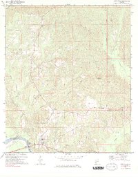
The Tombigbee River serves as the dominant geographical feature of this area, marking the boundary between Clarke and Choctaw Counties. This 1971 survey illustrates a landscape deeply defined by its river-and-creek network, where settlements like Coffeeville and Nichols Landing are situated relative to the waterway's bends. The interior terrain is a complex series of drainage basins, with Ulcanush Creek and Toland Mill Creek carving through the hills toward the main river.
Find a feature on this map
36 named features on this map. Tap any name to fly to it.
Don’t see what you’re looking for? This feature index may not catch every label — zoom into the map to look around manually.
Map Details
Editions of this 1971 Coffeeville Map
2 editions found
Other maps of this area

1953 · Andalusia
USGS Topo · 1:250,000

1953 · Hattiesburg
USGS Topo · 1:250,000

1957 · Andalusia
USGS Topo · 1:250,000

1958 · Hattiesburg
USGS Topo · 1:250,000

1971 · Ararat
USGS Topo · 1:24,000

1971 · Bladon Springs
USGS Topo · 1:24,000

1971 · Coffeeville Lock And Dam
USGS Topo · 1:24,000

1972 · Tattlersville
USGS Topo · 1:24,000

1972 · Woods Bluff
USGS Topo · 1:24,000

1978 · McEntyre
USGS Topo · 1:24,000