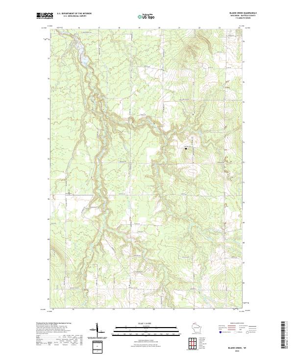
2022 Map of Blaine Creek
USGS Topo · Published 2022About this map
Iron River and its numerous tributaries, including the East Fork Iron River and Blaine Cr, carve through this section of northern Wisconsin. The landscape is defined by its drainage patterns, with minor waterways like Muskeg Cr and Resch Cr feeding into the larger river system. Human presence is marked by a grid of rural roads, often named for local families or geographical landmarks such as Saarkinen Rd, Hokkanen Rd, and Pudas Rd, suggesting a history of Scandinavian settlement common to the region. Near the center of the survey lies Hillside Cem, a significant point for genealogists researching families from the surrounding townships. The map details the transition from the upland roads like Copper Hill Rd down to the creek beds of Schaefer Cr and Middle Cr in the southeastern quadrant.
Find a feature on this map
51 named features on this map. Tap any name to fly to it.
Don’t see what you’re looking for? This feature index may not catch every label — zoom into the map to look around manually.
Map Details
Editions of this 2022 Blaine Creek Map
This is the sole edition of this map. No revisions or reprints were ever made.
Other maps of this area

1943 · Port Wing
USGS Topo · 1:48,000

1943 · Iron Lake
USGS Topo · 1:48,000

1946 · Port Wing
USGS Topo · 1:48,000

1947 · Brule
USGS Topo · 1:48,000

1947 · Iron Lake
USGS Topo · 1:48,000

1953 · Ashland
USGS Topo · 1:250,000

1958 · Ashland
USGS Topo · 1:250,000

1961 · Iron Lake SW
USGS Topo · 1:24,000
1961 · Iron Lake
USGS Topo · 1:62,500
1961 · Port Wing
USGS Topo · 1:62,500