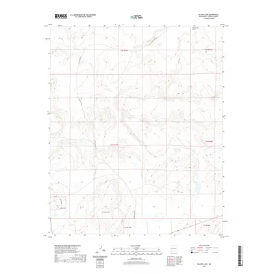
2020 Map of Blaines Lake
USGS Topo · Published 2020About this map
Agua Fria Cr winds through the high desert of Catron County, tracing a path through a landscape defined by dramatic elevation changes and remote ranch lands. This 2020 survey illustrates the high-altitude terrain where drainage systems like Cottonwood Canyon and the prominent Cimarron Mesa shape the local geography. The map reveals a sparse network of modern rural developments tucked into the southwestern corner, characterized by residential road names such as Antelope Way, Deer Cir, and Lariot Ln. The central namesake feature, Blaines Lake, serves as a primary reference point in a region primarily accessed via the long-stretching McKinley Ranch Rd. This record provides an essential look at the modern rural infrastructure and natural landmarks of the New Mexico interior, documenting the specific intersection of high-country mesas and seasonal watercourses.
Find a feature on this map
15 named features on this map. Tap any name to fly to it.
Don’t see what you’re looking for? This feature index may not catch every label — zoom into the map to look around manually.
Map Details
Editions of this 2020 Blaines Lake Map
This is the sole edition of this map. No revisions or reprints were ever made.
Other maps of this area

1954 · Saint Johns
USGS Topo · 1:250,000

1955 · Red Hill
USGS Topo · 1:24,000

1957 · Saint Johns
USGS Topo · 1:250,000

1958 · Saint Johns
USGS Topo · 1:250,000

1962 · Saint Johns
USGS Topo · 1:250,000

1972 · Zuni Salt Lake
USGS Topo · 1:24,000

1972 · Lake Armijo
USGS Topo · 1:24,000
1972 · Red Hill
USGS Topo · 1:24,000

1972 · Blaines Lake
USGS Topo · 1:24,000
1972 · Cow Springs
USGS Topo · 1:24,000