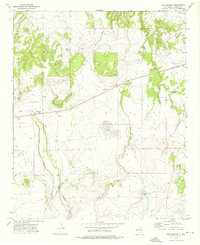
1972 Map of Cow Springs
USGS Topo · Published 1976About this map
Gould Ranch and Brockman Ranch anchor this high-desert landscape in Catron County, where water management is the primary driver of human settlement. The 1972 topography illustrates a system of vital water sources and ephemeral drainages, including the prominent Cow Springs Draw, Red Hill Draw, and Mayes Wash. These intermittent channels feed into local basins such as Chihuahua Lake and Cout Lake.
Find a feature on this map
14 named features on this map. Tap any name to fly to it.
Don’t see what you’re looking for? This feature index may not catch every label — zoom into the map to look around manually.
Map Details
Editions of this 1972 Cow Springs Map
This is the sole edition of this map. No revisions or reprints were ever made.
Other maps of this area

1886 · St Johns
USGS Topo · 1:250,000

1892 · St Johns
USGS Topo · 1:250,000

1954 · Saint Johns
USGS Topo · 1:250,000

1955 · Red Hill
USGS Topo · 1:24,000

1957 · Saint Johns
USGS Topo · 1:250,000

1958 · Saint Johns
USGS Topo · 1:250,000

1962 · Saint Johns
USGS Topo · 1:250,000
1968 · Nelson Reservoir NE
USGS Topo · 1:24,000
1968 · Loco Knoll
USGS Topo · 1:24,000
1971 · The Rincon
USGS Topo · 1:24,000