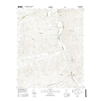
2014 Map of Blair
USGS Topo · Published 2014About this map
Sumter National Forest dominates the landscape of this region where the Tyger River, Enoree River, and Broad River converge at the borders of Union, Newberry, and Fairfield Counties. This territory is defined by its riparian history, evidenced by historic crossings like Greenshaws Ford, Lyles Ford, and Gordons Bridge. The map details a network of rural settlements including Maybinton, Strother, and Blair, which served as local hubs for the surrounding timber and agricultural lands. Genealogists will find significant value in the documentation of family and community burial grounds, such as James Ashford Cem, Weeping Mary Cem, and Seekwell Cem. The topography is marked by notable features such as Henderson Island and the Shelton Lookout Tower, while the southern edge reaches the Parr Shoals Reservoir, illustrating the geographic transition toward larger water management systems downstream.
Find a feature on this map
55 named features on this map. Tap any name to fly to it.
Don’t see what you’re looking for? This feature index may not catch every label — zoom into the map to look around manually.
Map Details
Editions of this 2014 Blair Map
This is the sole edition of this map. No revisions or reprints were ever made.
Other maps of this area

1904 · Columbia
USGS Topo · 1:125,000

1941 · Spartanburg
USGS Topo · 1:250,000

1953 · Spartanburg
USGS Topo · 1:250,000

1960 · Spartanburg
USGS Topo · 1:250,000

1963 · Spartanburg
USGS Topo · 1:250,000

1964 · Spartanburg
USGS Topo · 1:250,000

1968 · Newberry East
USGS Topo · 1:24,000

1969 · Whitmire South
USGS Topo · 1:24,000

1969 · Pomaria
USGS Topo · 1:24,000

1969 · Blair
USGS Topo · 1:24,000