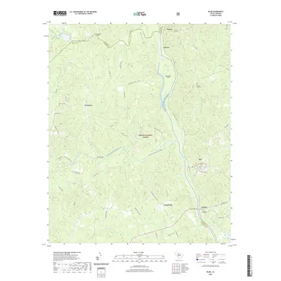
2020 Map of Blair
USGS Topo · Published 2020About this map
The Broad River serves as the central artery of this landscape, carving a path through the Sumter National Forest where Union, Newberry, and Fairfield counties meet. This area is defined by its fluvial geography, with the Tyger River and Enoree River flowing into the Broad, creating a complex network of waterways once vital for transport and trade. The presence of the Tyger River Canoe Trail and the Enoree River Canoe Trail reflects the area's transition into a recreational corridor within the protected forest lands.
Find a feature on this map
55 named features on this map. Tap any name to fly to it.
Don’t see what you’re looking for? This feature index may not catch every label — zoom into the map to look around manually.
Map Details
Editions of this 2020 Blair Map
This is the sole edition of this map. No revisions or reprints were ever made.
Other maps of this area

1904 · Columbia
USGS Topo · 1:125,000

1941 · Spartanburg
USGS Topo · 1:250,000

1953 · Spartanburg
USGS Topo · 1:250,000

1960 · Spartanburg
USGS Topo · 1:250,000

1963 · Spartanburg
USGS Topo · 1:250,000

1964 · Spartanburg
USGS Topo · 1:250,000

1968 · Newberry East
USGS Topo · 1:24,000

1969 · Whitmire South
USGS Topo · 1:24,000

1969 · Pomaria
USGS Topo · 1:24,000

1969 · Blair
USGS Topo · 1:24,000