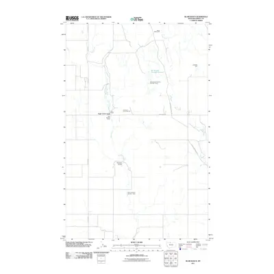
2011 Map of Blair Ranch
USGS Topo · Published 2011About this map
Eagle Creek Colony and Blair Ranch anchor this 2011 survey of the northern Montana plains. The landscape is defined by its water management and resource extraction, notably the Grandview Oil and Gas Field and a series of private and agricultural water works. Named structures like the Bourpe and Hamilton Number 1 Dam, Blair Number 2 Dam, and Skari and Sons Number 1 Dam indicate the critical importance of water storage for ranching operations in this arid environment. The terrain is marked by Antelope Coulee and the branching paths of Eagle Creek and Horse Creek. Transportation across the county remains tied to legacy routes, including the Old Whitlash Freight Rd, which provides a connection to the historical movement of goods across Liberty County.
Find a feature on this map
15 named features on this map. Tap any name to fly to it.
Don’t see what you’re looking for? This feature index may not catch every label — zoom into the map to look around manually.
Map Details
Editions of this 2011 Blair Ranch Map
This is the sole edition of this map. No revisions or reprints were ever made.
Other maps of this area

1954 · Shelby
USGS Topo · 1:250,000

1958 · Shelby
USGS Topo · 1:250,000

1962 · Tiber
USGS Topo · 1:24,000

1962 · Lakey Ranch
USGS Topo · 1:24,000

1962 · North Lothair School
USGS Topo · 1:24,000

1962 · Berkholder Reservoir
USGS Topo · 1:24,000

1962 · Blair Ranch
USGS Topo · 1:24,000

1962 · Haystack Butte
USGS Topo · 1:24,000

1962 · Mc Carters Lake SE
USGS Topo · 1:24,000

1962 · Mount Lebanon
USGS Topo · 1:24,000