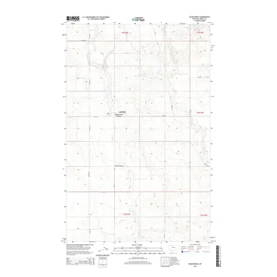
2014 Map of Blair Ranch
USGS Topo · Published 2014About this map
Eagle Creek Colony serves as a primary center of activity in this northern Montana landscape, located just east of the Blair Ranch. The area's economic foundations are evident in the presence of the Grandview Oil and Gas Field, which occupies several sections in the northern half of the map. This 2014 survey reveals a transition in the local infrastructure, where traditional names like Freight Rd and Oilmont Rd intersect with a modern systematic grid of numbered section roads. Drainage patterns are defined by the winding course of Eagle Cr, which flows south toward Antelope Coulee, and the presence of the Bourpe and Hamilton Reservoir, reflecting the essential nature of water management for agriculture and livestock in the Liberty County plains.
Find a feature on this map
21 named features on this map. Tap any name to fly to it.
Don’t see what you’re looking for? This feature index may not catch every label — zoom into the map to look around manually.
Map Details
Editions of this 2014 Blair Ranch Map
This is the sole edition of this map. No revisions or reprints were ever made.
Other maps of this area

1954 · Shelby
USGS Topo · 1:250,000

1958 · Shelby
USGS Topo · 1:250,000

1962 · Tiber
USGS Topo · 1:24,000

1962 · Lakey Ranch
USGS Topo · 1:24,000

1962 · North Lothair School
USGS Topo · 1:24,000

1962 · Berkholder Reservoir
USGS Topo · 1:24,000

1962 · Blair Ranch
USGS Topo · 1:24,000

1962 · Haystack Butte
USGS Topo · 1:24,000

1962 · Mc Carters Lake SE
USGS Topo · 1:24,000

1962 · Mount Lebanon
USGS Topo · 1:24,000