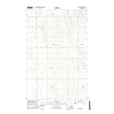
2017 Map of Blair Ranch
USGS Topo · Published 2017About this map
The northern Montana plains in Liberty County are defined here by a network of historic ranching routes and water management. Central to the area is the Blair Ranch, situated along the winding path of Eagle Cr. The landscape is characterized by its drainage patterns, including the prominent Antelope Coulee and the branching waters of Little Horse Cr and Horse Cr. Man-made infrastructure like the Bourpe and Hamilton Reservoir underscores the importance of water storage in this arid agricultural region. Transportation history is well-preserved through the path of the Old Whitlash Freight Rd, a name that recalls the era of heavy freighting across the high plains. Other local thoroughfares like Horse Creek Rd and Oilmont Rd connect the scattered homesteads and pastures that fill this vast reach of the Big Sky state.
Find a feature on this map
19 named features on this map. Tap any name to fly to it.
Don’t see what you’re looking for? This feature index may not catch every label — zoom into the map to look around manually.
Map Details
Editions of this 2017 Blair Ranch Map
This is the sole edition of this map. No revisions or reprints were ever made.
Other maps of this area

1954 · Shelby
USGS Topo · 1:250,000

1958 · Shelby
USGS Topo · 1:250,000

1962 · Tiber
USGS Topo · 1:24,000

1962 · Lakey Ranch
USGS Topo · 1:24,000

1962 · North Lothair School
USGS Topo · 1:24,000

1962 · Berkholder Reservoir
USGS Topo · 1:24,000

1962 · Blair Ranch
USGS Topo · 1:24,000

1962 · Haystack Butte
USGS Topo · 1:24,000

1962 · Mc Carters Lake SE
USGS Topo · 1:24,000

1962 · Mount Lebanon
USGS Topo · 1:24,000