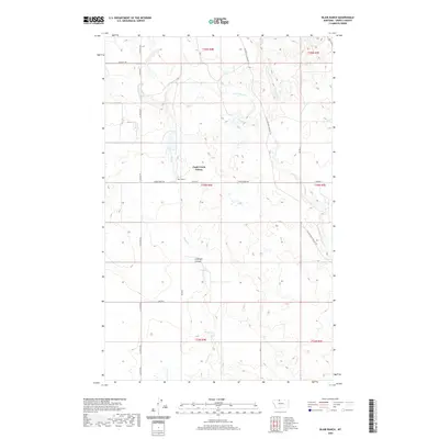
2020 Map of Blair Ranch
USGS Topo · Published 2020About this map
Eagle Creek Colony sits at the heart of this North Central Montana landscape, characterized by the wide, undulating drainages of the High Plains. The area is defined by the ephemeral flows of Eagle Cr and Little Horse Cr, which carve through the terrain to form landmarks like Antelope Coulee. The map illustrates a rural economy organized around large landholdings and a grid of section-line roads, including the historical corridor of the Old Whitlash Freight Rd, which once served as a vital transport link for this corner of Liberty County. Named for the Blair Ranch, the region maintains a traditional Montana ranching footprint, where local routes like Horse Creek Rd and Oilmont Rd connect isolated homesteads and agricultural colonies across the vast sections of the Public Land Survey System.
Find a feature on this map
22 named features on this map. Tap any name to fly to it.
Don’t see what you’re looking for? This feature index may not catch every label — zoom into the map to look around manually.
Map Details
Editions of this 2020 Blair Ranch Map
This is the sole edition of this map. No revisions or reprints were ever made.
Other maps of this area

1954 · Shelby
USGS Topo · 1:250,000

1958 · Shelby
USGS Topo · 1:250,000

1962 · Tiber
USGS Topo · 1:24,000

1962 · Lakey Ranch
USGS Topo · 1:24,000

1962 · North Lothair School
USGS Topo · 1:24,000

1962 · Berkholder Reservoir
USGS Topo · 1:24,000

1962 · Blair Ranch
USGS Topo · 1:24,000

1962 · Haystack Butte
USGS Topo · 1:24,000

1962 · Mc Carters Lake SE
USGS Topo · 1:24,000

1962 · Mount Lebanon
USGS Topo · 1:24,000