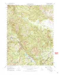
2022 Map of Blairsden
USGS Topo · Published 2022About this map
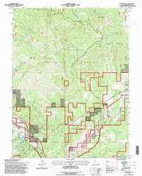
Mohawk Valley serves as the central corridor for this part of the Sierra Nevada, where the communities of Blairsden and Clio are established along the drainage of the Feather Wild and Scenic River. This high-elevation landscape is defined by the steep rises of Smith Peak and Penman Peak, which overlook the surrounding Plumas National Forest. The map shows a clear division between the more developed residential pockets in Mohawk Vista and the more remote reaches of Humbug Valley and Threemile Valley. Local roads and trails, such as Lower Mills Peak Trl and the cluster of indigenous-named streets like Paiute Trl and Shasta Trl, provide a detailed look at the modern footprint of these mountain settlements. Many small watercourses, including Willow Creek and Frazier Cr, drain the high ridges of Bonta Ridge and Gold Mountain toward the valley floor.
Find a feature on this map
87 named features on this map. Tap any name to fly to it.
Don’t see what you’re looking for? This feature index may not catch every label — zoom into the map to look around manually.
Map Details
Editions of this 2022 Blairsden Map
This is the sole edition of this map. No revisions or reprints were ever made.
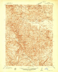
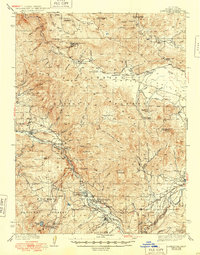
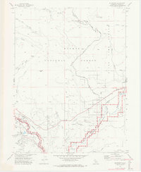
Historical Maps of Five Points Through Time
6 maps found