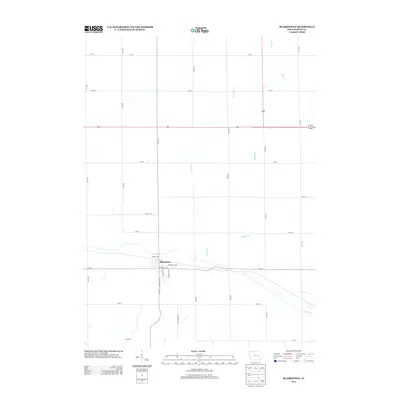
2013 Map of Blairstown
USGS Topo · Published 2013About this map
Blairstown serves as the primary settlement on this Benton County landscape, situated along the northern bank of Prairie Cr. The town’s grid is clearly defined by historical street names such as Iowa St NW, Prospect St NE, and Fremont St SE, reflecting a structured agricultural hub typical of the Iowa prairie. The surrounding terrain is defined by a dendritic drainage pattern where several small waterways, including Weasel Cr and Buffalo Cr, flow through the section lines toward the larger creek systems. To the south, Coon Cr meanders through the fields, while Mud Cr marks the northeastern corner of the study area. This 2013 survey illustrates the enduring relationship between the rectangular survey system of rural roads like 71st St and 25th Ave and the natural watercourses that break the geometric regularity of the farmland.
Find a feature on this map
29 named features on this map. Tap any name to fly to it.
Don’t see what you’re looking for? This feature index may not catch every label — zoom into the map to look around manually.
Map Details
Editions of this 2013 Blairstown Map
This is the sole edition of this map. No revisions or reprints were ever made.
Other maps of this area

1888 · Shellsburg
USGS Topo · 1:62,500

1888 · Amana
USGS Topo · 1:62,500

1889 · Amana
USGS Topo · 1:62,500

1889 · Shellsburg
USGS Topo · 1:62,500

1899 · Amana
USGS Topo · 1:62,500

1899 · Shellsburg
USGS Topo · 1:62,500

1903 · Fairfax
USGS Topo · 1:125,000

1903 · Winthrop
USGS Topo · 1:125,000

1954 · Waterloo
USGS Topo · 1:250,000

1954 · Des Moines
USGS Topo · 1:250,000