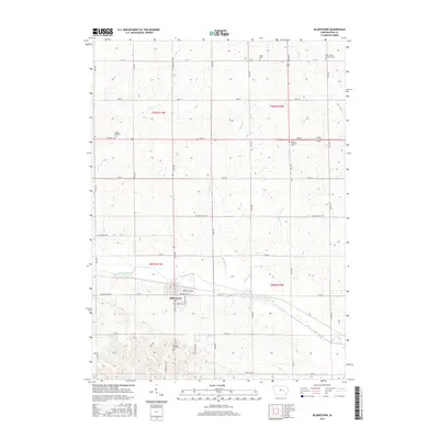
2015 Map of Blairstown
USGS Topo · Published 2015About this map
Blairstown serves as the central hub for this portion of the Iowa countryside, situated where the grid of county roads and sections meets the meandering course of Prairie Creek. The map reveals a landscape defined by its agricultural heritage and communal anchors, with five distinct burial grounds marking the history of local congregations and families. These include Salem Cem in the north and Calvary Catholic Cem further west, alongside Saint John's Lutheran Cem, Prairie Lutheran Cem, and Pleasant Hill Cem. The natural drainage of the region is traced by several small waterways such as Mud Cr, Weasel Cr, and Buffalo Cr, which cut through the surveyed sections. Within the town limits, specific street names like Prospect St NE and Cross St SE provide a fine-grained look at the residential layout of this Benton County community.
Find a feature on this map
28 named features on this map. Tap any name to fly to it.
Don’t see what you’re looking for? This feature index may not catch every label — zoom into the map to look around manually.
Map Details
Editions of this 2015 Blairstown Map
This is the sole edition of this map. No revisions or reprints were ever made.
Other maps of this area

1888 · Shellsburg
USGS Topo · 1:62,500

1888 · Amana
USGS Topo · 1:62,500

1889 · Amana
USGS Topo · 1:62,500

1889 · Shellsburg
USGS Topo · 1:62,500

1899 · Amana
USGS Topo · 1:62,500

1899 · Shellsburg
USGS Topo · 1:62,500

1903 · Fairfax
USGS Topo · 1:125,000

1903 · Winthrop
USGS Topo · 1:125,000

1954 · Waterloo
USGS Topo · 1:250,000

1954 · Des Moines
USGS Topo · 1:250,000