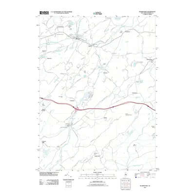
2011 Map of Blairstown
USGS Topo · Published 2011About this map
Paulins Kill winds through the northern half of this landscape, anchoring several long-established settlements such as Blairstown and Paulina. The township's character is defined by a mix of early industrial relics and sprawling natural spaces, from the Kishpaugh Mines near Marble Hill to the elevated reaches of Jenny Jump Mountain. For genealogists, the map is particularly dense with burial grounds, including the Moravian Cemetery and Swayze Cemetery, reflecting the area's deep roots in the Kittatinny Valley.
Find a feature on this map
132 named features on this map. Tap any name to fly to it.
Don’t see what you’re looking for? This feature index may not catch every label — zoom into the map to look around manually.
Map Details
Editions of this 2011 Blairstown Map
This is the sole edition of this map. No revisions or reprints were ever made.
Other maps of this area

1888 · Hackettstown
USGS Topo · 1:62,500

1891 · Wallpack
USGS Topo · 1:62,500

1891 · Delaware Water Gap
USGS Topo · 1:62,500

1893 · Delaware Water Gap
USGS Topo · 1:62,500

1893 · Wallpack
USGS Topo · 1:62,500

1894 · Hackettstown
USGS Topo · 1:62,500

1898 · Hackettstown
USGS Topo · 1:62,500

1900 · Raritan
USGS Topo · 1:125,000

1905 · Raritan
USGS Topo · 1:125,000

1905 · Hackettstown
USGS Topo · 1:62,500
Featured Places
- Blairstown, NJ
- Allamuchy Township, NJ
- Hope Township, NJ
- Hardwick Township, NJ
- Marble Hill, Liberty Township