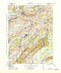
1943 Map of Blairstown
USGS Topo · Published 1943About this map
Paulins Kill carves a path through this part of Warren County, anchoring a landscape where early industry and education intersect. The prominent campus of Blair Academy sits just north of Blairstown, a hub formerly served by the Blairstown Station. The 1940s terrain is marked by a transition from agricultural and dairy operations, such as Meadowbrook Dairy, to the wooded heights of Jenny Jump State Forest.
Find a feature on this map
49 named features on this map. Tap any name to fly to it.
Don’t see what you’re looking for? This feature index may not catch every label — zoom into the map to look around manually.
Map Details
Editions of this 1943 Blairstown Map
This is the sole edition of this map. No revisions or reprints were ever made.
Other maps of this area

1888 · Hackettstown
USGS Topo · 1:62,500

1891 · Wallpack
USGS Topo · 1:62,500

1891 · Delaware Water Gap
USGS Topo · 1:62,500

1893 · Delaware Water Gap
USGS Topo · 1:62,500

1893 · Wallpack
USGS Topo · 1:62,500

1894 · Hackettstown
USGS Topo · 1:62,500

1898 · Hackettstown
USGS Topo · 1:62,500

1900 · Raritan
USGS Topo · 1:125,000

1905 · Raritan
USGS Topo · 1:125,000

1905 · Hackettstown
USGS Topo · 1:62,500
Featured Places
- Blairstown, NJ
- Allamuchy Township, NJ
- Hope Township, NJ
- Hardwick Township, NJ
- Marksboro, Frelinghuysen Township