
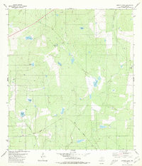
1980 Map of Blancas Creek North
USGS Topo · Published 1980About this map
Dolores Creek and Lobo Creek dominate this South Texas landscape in Webb County, where the topography is defined by seasonal water drainage and early energy infrastructure. Surveyed in the mid-1970s, the terrain reveals a sparse but deliberate network of cattle fences and utility pipelines that cross the brush country. The presence of a localized well in the northwest corner highlights the ongoing importance of groundwater and resource extraction in this arid ranching environment. The mapping of Blancas Creek in the southeast provides a clear look at the natural hydrology of the area before modern large-scale development altered the rural character of the region.
Find a feature on this map
5 named features on this map. Tap any name to fly to it.
Don’t see what you’re looking for? This feature index may not catch every label — zoom into the map to look around manually.
Map Details
Editions of this 1980 Blancas Creek North Map
This is the sole edition of this map. No revisions or reprints were ever made.
Other maps of this area

1933 · Becerra Creek
USGS Topo · 1:62,500

1937 · Aguilete Creek
USGS Topo · 1:62,500

1940 · Aguilares
USGS Topo · 1:62,500

1956 · Laredo East
USGS Topo · 1:62,500

1956 · Laredo
USGS Topo · 1:250,000

1965 · Tios Creek
USGS Topo · 1:24,000

1965 · Laredo East
USGS Topo · 1:24,000

1979 · Laredo South
USGS Topo · 1:24,000

1979 · O'Keefe Lake
USGS Topo · 1:24,000
1980 · Burrito Tank
USGS Topo · 1:24,000
Featured Places
- Laredo, TX
- Laredo Ranchettes Colonia, TX
- Las Blancas Colonia, Laredo
- San Carlos Number 2 Colonia, TX
- San Carlos Number 1 Colonia, TX