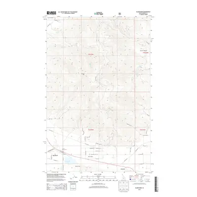
2013 Map of Blanchard
USGS Topo · Published 2013About this map
Blanchard sits at the base of the prominent Hoodoo Mtn in southern Bonner County, where the valley floor transitions into the high timberlands of northern Idaho. This 2013 survey illustrates the local infrastructure and land use, including the Pine Grove Cem and the small settlement of Coleman to the southeast. The landscape is defined by its water system, where Blanchard Cr flows into Blanchard Lake before continuing through Spirit Valley as Spirit Cr. The map details a complex network of local access roads such as Pole Line Rd and Blanchard Elk Rd that serve the outlying residential and agricultural properties. Further north, the terrain becomes increasingly complex, marked by features like Mountain Meadow and Melder Draw, providing a clear view of the drainage patterns for Fish Cr and McDonald Cr.
Find a feature on this map
51 named features on this map. Tap any name to fly to it.
Don’t see what you’re looking for? This feature index may not catch every label — zoom into the map to look around manually.
Map Details
Editions of this 2013 Blanchard Map
This is the sole edition of this map. No revisions or reprints were ever made.
Other maps of this area

1901 · Sandpoint
USGS Topo · 1:125,000

1901 · Spokane
USGS Topo · 1:125,000

1903 · Rathdrum
USGS Topo · 1:125,000

1911 · Priest Lake
USGS Topo · 1:250,000

1911 · Sandpoint
USGS Topo · 1:125,000

1913 · Priest Lake
USGS Topo · 1:250,000

1936 · Newport
USGS Topo · 1:96,000

1942 · Newport
USGS Topo · 1:125,000

1943 · Mt Spokane
USGS Topo · 1:62,500

1950 · Mt Spokane
USGS Topo · 1:62,500