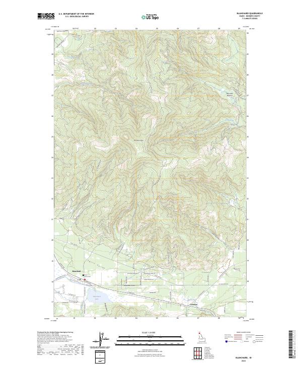
2024 Map of Blanchard
USGS Topo · Published 2024About this map
Blanchard sits at the southern edge of this Idaho survey, where the valley floor transitions into the significant elevations of Hoodoo Mtn. The settlement is closely tied to the geography of Spirit Valley, with the waters of Blanchard Lake and Blanchard Creek providing a focal point for local development. Further east, the smaller community of Coleman is situated along Spirit Creek, showing the persistent pattern of residential clusters following the narrow corridors between steep ridgelines.
Find a feature on this map
62 named features on this map. Tap any name to fly to it.
Don’t see what you’re looking for? This feature index may not catch every label — zoom into the map to look around manually.
Map Details
Editions of this 2024 Blanchard Map
This is the sole edition of this map. No revisions or reprints were ever made.
Other maps of this area

1901 · Sandpoint
USGS Topo · 1:125,000

1901 · Spokane
USGS Topo · 1:125,000

1903 · Rathdrum
USGS Topo · 1:125,000

1911 · Priest Lake
USGS Topo · 1:250,000

1911 · Sandpoint
USGS Topo · 1:125,000

1913 · Priest Lake
USGS Topo · 1:250,000

1936 · Newport
USGS Topo · 1:96,000

1942 · Newport
USGS Topo · 1:125,000

1943 · Mt Spokane
USGS Topo · 1:62,500

1950 · Mt Spokane
USGS Topo · 1:62,500