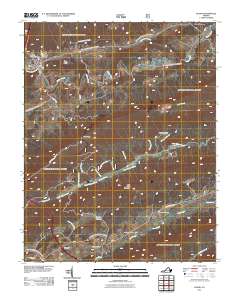
2011 Map of Bland
USGS Topo · Published 2011About this map
Bland serves as the central settlement on this map, situated where several waterways and ridges converge. The terrain is defined by the prominent Town Ridge and the heights of Little Walker Mountain, which separates the northern valley of Walker Creek from the southern drainages of Little Walker Creek and Cove Creek. The landscape is etched with numerous named branches and springs, such as Poplar Spring Branch and Helveys Mill Creek, suggesting a deep reliance on the area's natural drainage patterns for historical settlement and agriculture.
Find a feature on this map
33 named features on this map. Tap any name to fly to it.
Don’t see what you’re looking for? This feature index may not catch every label — zoom into the map to look around manually.
Map Details
Editions of this 2011 Bland Map
This is the sole edition of this map. No revisions or reprints were ever made.
Other maps of this area

1887 · Pocahontas
USGS Topo · 1:125,000

1889 · Hillsville
USGS Topo · 1:125,000

1889 · Wytheville
USGS Topo · 1:125,000

1890 · Dublin
USGS Topo · 1:125,000

1891 · Pocahontas
USGS Topo · 1:125,000

1891 · Dublin
USGS Topo · 1:125,000

1892 · Hillsville
USGS Topo · 1:125,000

1892 · Wytheville
USGS Topo · 1:125,000

1894 · Pocahontas
USGS Topo · 1:125,000

1895 · Pocahontas
USGS Topo · 1:125,000