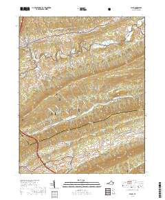
2019 Map of Bland
USGS Topo · Published 2019About this map
Bland serves as a focal point for this section of the Appalachian Highlands, situated along Crab Orchard Cr at the base of Town Ridge. As the seat of local government, the Bland County Courthouse stands near the intersection of several primary routes, including State Rte 604. The landscape is defined by parallel ridges and narrow valleys, with Jefferson National Forest blanketing much of the high ground on Walker Mtn and Little Walker Mtn.
Find a feature on this map
50 named features on this map. Tap any name to fly to it.
Don’t see what you’re looking for? This feature index may not catch every label — zoom into the map to look around manually.
Map Details
Editions of this 2019 Bland Map
This is the sole edition of this map. No revisions or reprints were ever made.
Other maps of this area

1887 · Pocahontas
USGS Topo · 1:125,000

1889 · Hillsville
USGS Topo · 1:125,000

1889 · Wytheville
USGS Topo · 1:125,000

1890 · Dublin
USGS Topo · 1:125,000

1891 · Pocahontas
USGS Topo · 1:125,000

1891 · Dublin
USGS Topo · 1:125,000

1892 · Hillsville
USGS Topo · 1:125,000

1892 · Wytheville
USGS Topo · 1:125,000

1894 · Pocahontas
USGS Topo · 1:125,000

1895 · Pocahontas
USGS Topo · 1:125,000