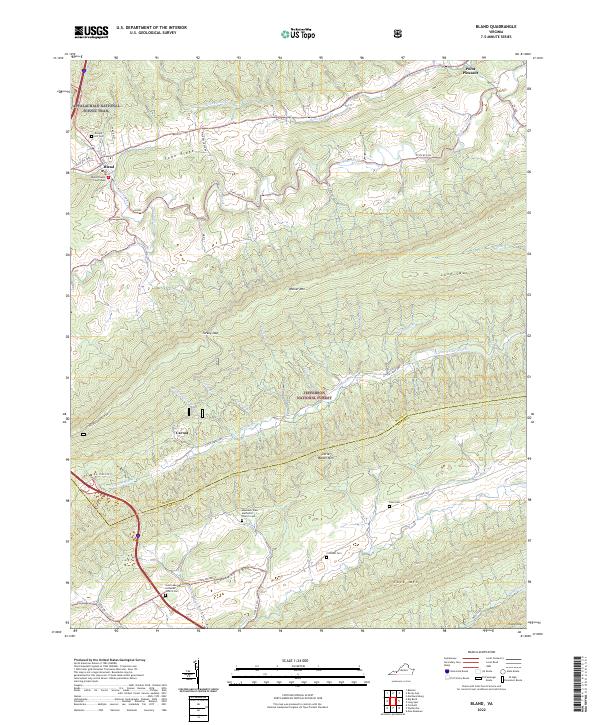
2022 Map of Bland
USGS Topo · Published 2022About this map
The Bland County Courthouse serves as the focal point for this Virginia county seat, situated along the northern slopes of Town Ridge. The landscape is defined by the rhythmic parallel ridges of the Appalachian Mountains, including Walker Mtn and Little Walker Mtn. These peaks divide the various branches of the Walker Creek watershed, creating isolated valleys such as Crockett Cove. This area preserves significant local heritage through its numerous rural burial grounds and places of worship, such as Saint Luke Lutheran Church Cem and the Mountain View Methodist Church Cem located near Little Creek Hwy. The Appalachian National Scenic Trail traverses the northern ridges, while vast sections of the Jefferson National Forest dominate the southern half of the quadrangle, illustrating the enduring balance between small-town settlement and protected mountain wilderness.
Find a feature on this map
52 named features on this map. Tap any name to fly to it.
Don’t see what you’re looking for? This feature index may not catch every label — zoom into the map to look around manually.
Map Details
Editions of this 2022 Bland Map
This is the sole edition of this map. No revisions or reprints were ever made.
Other maps of this area

1887 · Pocahontas
USGS Topo · 1:125,000

1889 · Hillsville
USGS Topo · 1:125,000

1889 · Wytheville
USGS Topo · 1:125,000

1890 · Dublin
USGS Topo · 1:125,000

1891 · Pocahontas
USGS Topo · 1:125,000

1891 · Dublin
USGS Topo · 1:125,000

1892 · Hillsville
USGS Topo · 1:125,000

1892 · Wytheville
USGS Topo · 1:125,000

1894 · Pocahontas
USGS Topo · 1:125,000

1895 · Pocahontas
USGS Topo · 1:125,000