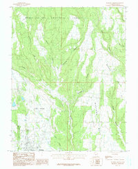
1985 Map of Blanding North
USGS Topo · Published 1985About this map
Blanding anchors the southern edge of this high-desert plateau, where the town's street grid meets the canyonlands of San Juan County. The landscape is defined by a series of north-south drainage systems, including the prominent Recapture Creek and Johnson Creek, which have carved deep into the sandstone. To the north, the terrain rises into the timbered slopes of the Manti-La Sal National Forest, illustrating the transition from arid mesas to alpine environments.
Find a feature on this map
20 named features on this map. Tap any name to fly to it.
Don’t see what you’re looking for? This feature index may not catch every label — zoom into the map to look around manually.
Map Details
Editions of this 1985 Blanding North Map
This is the sole edition of this map. No revisions or reprints were ever made.
Other maps of this area

1886 · Abajo
USGS Topo · 1:250,000

1892 · Abajo
USGS Topo · 1:250,000

1893 · Abajo
USGS Topo · 1:250,000

1935 · Elk Ridge
USGS Topo · 1:96,000

1940 · Elk Ridge
USGS Topo · 1:125,000

1954 · Elk Ridge 1 SE
USGS Topo · 1:24,000
1954 · Mt Linnaeus
USGS Topo · 1:62,500

1955 · Verdure 2 SE
USGS Topo · 1:24,000

1955 · Verdure 3 SE
USGS Topo · 1:24,000

1955 · Verdure 3 NE
USGS Topo · 1:24,000