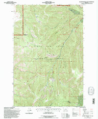
1995 Map of Blankenbaker Flats
USGS Topo · Published 1997About this map
Lewis and Clark National Forest encompasses the vast majority of this high-altitude landscape along the border of Cascade and Meagher counties. The terrain is defined by a dense network of drainages and prominent ridges, including the nearly 8,000-foot heights of Monument Ridge and the distinctively flat upland of Blankenbaker Flats. These features illustrate the complex topography of the Little Belt Mountains, where numerous creeks like Deep Creek and Logging Creek have carved deep incisions into the plateau.
Find a feature on this map
27 named features on this map. Tap any name to fly to it.
Don’t see what you’re looking for? This feature index may not catch every label — zoom into the map to look around manually.
Map Details
Editions of this 1995 Blankenbaker Flats Map
This is the sole edition of this map. No revisions or reprints were ever made.
Other maps of this area

1886 · Great Falls
USGS Topo · 1:250,000

1886 · Fort Logan
USGS Topo · 1:250,000

1886 · Little Belt Mts.
USGS Topo · 1:250,000

1890 · Fort Benton
USGS Topo · 1:250,000

1892 · Fort Benton
USGS Topo · 1:250,000

1894 · Little Belt Mts.
USGS Topo · 1:250,000

1897 · Fort Benton
USGS Topo · 1:250,000

1897 · Little Belt Mts.
USGS Topo · 1:250,000

1898 · Little Belt Mts.
USGS Topo · 1:250,000

1902 · Little Belt Mts.
USGS Topo · 1:250,000