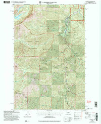
2003 Map of Blewett
USGS Topo · Published 2006About this map
The eastern slopes of the Stuart Range define this 2003 revision, where the Wenatchee National Forest meets the Alpine Lakes Wilderness. The landscape is a complex of mining and hydrology, centered on Peshastin Creek and its many tributaries like Hansel Creek and Ingalls Creek.
Find a feature on this map
55 named features on this map. Tap any name to fly to it.
Don’t see what you’re looking for? This feature index may not catch every label — zoom into the map to look around manually.
Map Details
Editions of this 2003 Blewett Map
This is the sole edition of this map. No revisions or reprints were ever made.
Other maps of this area

1897 · Mount Stuart
USGS Topo · 1:125,000

1901 · Chiwaukum
USGS Topo · 1:125,000

1902 · Mount Stuart
USGS Topo · 1:125,000

1904 · Chiwaukum
USGS Topo · 1:125,000

1957 · Wenatchee
USGS Topo · 1:250,000

1961 · Liberty
USGS Topo · 1:62,500

1961 · Mount Stuart
USGS Topo · 1:62,500

1964 · Leavenworth
USGS Topo · 1:62,500

1965 · Chiwaukum Mts
USGS Topo · 1:62,500

1975 · Wenatchee
USGS Topo · 1:100,000