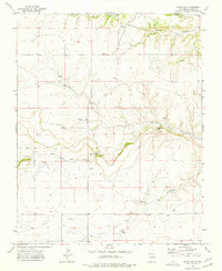
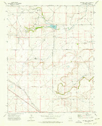
1973 Map of Blind Gap
USGS Topo · Published 1977About this map
Corrumpa Creek and a network of ephemeral waterways define this high-plains landscape in Union County, where the topography transitions through prominent breaks like Blind Gap and Telephone Gap. The map provides a clear look at the rural infrastructure of the early 1970s, featuring the isolated Smith Landing Strips and several Wells and Well sites that supported ranching operations in this arid region.
Find a feature on this map
15 named features on this map. Tap any name to fly to it.
Don’t see what you’re looking for? This feature index may not catch every label — zoom into the map to look around manually.
Map Details
Editions of this 1973 Blind Gap Map
This is the sole edition of this map. No revisions or reprints were ever made.
Other maps of this area

1954 · Dalhart
USGS Topo · 1:250,000

1958 · Dalhart
USGS Topo · 1:250,000

1962 · Dalhart
USGS Topo · 1:250,000

1972 · Mount Dora
USGS Topo · 1:24,000
1972 · Guy
USGS Topo · 1:24,000
1972 · Fiddler Springs
USGS Topo · 1:24,000

1972 · Cross L Ranch SW
USGS Topo · 1:24,000
1972 · Boiler Gap
USGS Topo · 1:24,000
1973 · Wetherly Lake
USGS Topo · 1:24,000

1973 · Grenville SW
USGS Topo · 1:24,000