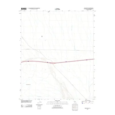
2012 Map of Blind Hills
USGS Topo · Published 2012About this map
The Clipper Mountains rise in the southwestern portion of this Mojave Desert landscape, providing a stark geographic anchor to an area defined by wide alluvial plains and seasonal drainages. In this arid corner of San Bernardino County, vital water sources like Hummingbird Spring and prominent elevations such as Halfway Hill served as essential landmarks for desert travelers long before modern infrastructure. The map illustrates a high-desert environment where the vast Black Canyon Wash cuts through the terrain, illustrating the powerful role of flash floods in shaping the local geology. This 2012 survey captures the intersection of natural isolation and human transit, showing the transit corridors of Essex Rd and Hidden Hills Rd as they traverse the slopes of the Blind Hills. The presence of these named desert tracks highlights the continued importance of remote access routes in a region otherwise dominated by the open desert floor.
Find a feature on this map
7 named features on this map. Tap any name to fly to it.
Don’t see what you’re looking for? This feature index may not catch every label — zoom into the map to look around manually.
Map Details
Editions of this 2012 Blind Hills Map
This is the sole edition of this map. No revisions or reprints were ever made.
Other maps of this area

1942 · Amboy
USGS Topo · 1:250,000

1943 · Amboy
USGS Topo · 1:250,000

1943 · Essex
USGS Topo · 1:62,500

1943 · Danby
USGS Topo · 1:62,500

1943 · Fenner
USGS Topo · 1:62,500

1954 · Needles
USGS Topo · 1:250,000

1956 · Needles
USGS Topo · 1:250,000

1956 · Fenner
USGS Topo · 1:62,500

1956 · Essex
USGS Topo · 1:62,500

1956 · Colton Well
USGS Topo · 1:62,500